
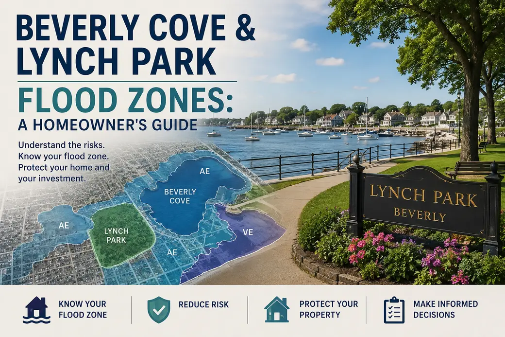
Beverly Cove & Lynch Park Flood Zones: A Homeowner's Guide
Flood Zones, Flood Insurance, and the Future of Beverly Cove & Lynch Park
What waterfront and near-waterfront homeowners in these two Beverly neighborhoods should actually know — separating real news from rumor.
If you own a home near Beverly Cove or Lynch Park, or you're thinking about buying one, you've probably heard some version of "they're changing the flood maps." It's a conversation that comes up a lot along the harbor, and for good reason — flood zone status affects everything from your mortgage requirements to your annual insurance bill to what a buyer is willing to offer.
I've lived in Beverly for most of my life, and I've watched this stretch of coastline through a lot of storms. So let me tell you what's actually happening, and what isn't, so you can make decisions based on facts rather than what you heard at the dog park.
First, the straight answer on the maps
As of this writing, I haven't found evidence that FEMA has issued new, updated flood insurance rate maps for Beverly. The most recent official change I could confirm was back in 2017, when FEMA approved revisions to two sections of the coastline — one running roughly from Quincy Park to Bay View Avenue, the other from Paine Avenue to the Manchester line. Those revisions are still what's in effect today.
That doesn't mean nothing is happening, though. It means the real story right now isn't a map change — it's a resilience story. And if you own property near the water, that story matters just as much.
The real news: Lynch Park's resilience plan
Lynch Park has taken real hits in recent years. Winter Storm Finn caused significant flood damage there in January 2024, and it wasn't the first time the park's low-lying areas have taken on water during a coastal storm. In response, the City secured a Coastal Resilience Grant from the Massachusetts Office of Coastal Zone Management back in 2023 to develop a long-term plan for protecting the park.
The City ran a community survey that pulled in more than 800 responses, and from that feedback, two conceptual design directions emerged. One, sometimes called the "Coastal Habitat Core" approach, focuses on expanding the beach into the current lawn area and relocating structures like the bandshell — essentially returning part of the site to the wetland it historically was. The other, the "Lifted Lawn" concept, focuses on elevating the existing lawn with fill and adding drainage around the edges, along with a new elevated beach area.
Neither of these is a FEMA flood map change. But they matter to you as a homeowner for a simple reason: how a coastal community invests in resilience infrastructure — dunes, elevation, drainage, wetland restoration — shapes flood risk over the long term, and flood risk is exactly what future map revisions and insurance pricing get built around. This is a "watch this space" situation, not a "the rules just changed" situation.
How flood zones actually affect your insurance
Whether or not the maps change, it's worth understanding how this works, because a lot of homeowners near the water assume they know more than they do.
If your property sits in what FEMA calls a Special Flood Hazard Area — you'll usually see it labeled Zone AE or Zone VE along the coast — and you have a federally backed mortgage, flood insurance isn't optional. Zone VE, which applies to areas with wave action risk, typically carries the highest premiums because the potential for structural damage is greater. Homes just outside the mapped high-risk zone can still flood, which is why plenty of owners in Beverly Cove and around Lynch Park choose to carry flood coverage even when it isn't required.
FEMA also changed how it prices flood insurance policies a few years ago, moving to a system called Risk Rating 2.0. Instead of pricing almost entirely off which flood zone a home sits in, it factors in details specific to the property — elevation, distance to water, rebuilding cost, and flood history among them. Practically speaking, that means two homes a few doors apart in the same flood zone can end up with meaningfully different premiums.
What this means if you're selling
Massachusetts requires honest disclosure of known material defects, and flood zone status is exactly the kind of thing an informed buyer is going to ask about — or find on their own during due diligence. Being upfront about it, and having your flood insurance costs and any elevation certificate ready to share, tends to build trust rather than scare buyers off. Waterfront living on the North Shore comes with tradeoffs everyone already understands; buyers respect a seller who's transparent about them.
What this means if you're buying
Before you fall in love with a place near the Cove or the park, check the property's current flood zone status yourself and get a real insurance quote — not an estimate — before you're deep into a purchase and sale agreement. Flood insurance costs can swing a monthly payment more than people expect, and it's much easier to factor that into your offer than to be surprised by it at closing.
Thinking about buying or selling near Beverly Harbor?
Flood zone questions come up in nearly every waterfront conversation I have. I can walk you through what a specific property's status actually means — and what it doesn't — before you make a decision. No pressure, just a straight answer.
Schedule a ConsultationFrequently Asked Questions
Is my Beverly Cove or Lynch Park home in a FEMA flood zone?
It depends on the specific parcel. Properties closer to the harbor and shoreline are more likely to fall within a Special Flood Hazard Area, but this varies block by block. Check your address directly through FEMA's Flood Map Service Center for an official determination.
Has FEMA released new flood maps for Beverly recently?
Not that I've been able to confirm. The last official revision affecting the Beverly coastline dates to 2017. If a new map is released, it would typically come with a public comment period before taking effect, and I'll update this post if that happens.
Do I have to buy flood insurance if I'm in a high-risk zone?
If you have a federally backed mortgage and your home sits in a Special Flood Hazard Area (Zone A, AE, VE, and similar), flood insurance is generally required by your lender. Outside those zones, it's optional but often still worth considering along the coast.
How does the Lynch Park resilience project affect my flood insurance?
Not directly, and not yet. It's a City-led planning effort to protect the park itself from storm damage and sea level rise, separate from FEMA's flood mapping process. Over time, resilience investments like this can influence flood risk in an area, but that's a long-term consideration rather than something that changes your premium today.
How much does flood insurance typically cost in this area?
It varies significantly by elevation, distance to the water, and the specific flood zone your property falls in. National average NFIP premiums run a few hundred dollars a year, but coastal Zone VE properties in particular can run well above that. I'd recommend getting a specific quote for any property you're considering rather than relying on averages.
What should I do before listing or buying a waterfront home here?
Confirm the current flood zone designation directly with FEMA, request a real insurance quote rather than an estimate, and if you're selling, have your documentation — elevation certificate, insurance history, any flood mitigation work — organized and ready to share.

A North Shore resident since 1961 and a Beverly-based Realtor since 2000, Jim has spent 25+ years helping buyers and sellers navigate the details that actually matter along the Massachusetts coast.
Categories
- All Blogs (201)
- Beverly, MA (14)
- Buying a Home (97)
- Condos For Sale (7)
- Danvers, MA (2)
- Estates & Inherited Homes (3)
- Gloucester, MA (1)
- Home Ownership (49)
- Home Sellers Guide (20)
- Homes For Sale (10)
- Ipswich, MA (2)
- Jim Armstrong (1)
- Landlords (1)
- Living on the North SHore (31)
- Mortgages (16)
- Peabody, MA (1)
- Prospective Real Estate Agents (1)
- Real Estate Careers (7)
- Real Estate Market Conditions (44)
- Real Estate School (2)
- Renting (1)
- Salem, MA (15)
- Selling a home (104)
- Senior Living (2)
- Swampscott, MA (1)
Recent Posts